
 When the annual Pumpkin Festival turned into an ugly riot in Keene, New Hampshire, local police turned to online crowdsourcing to collect images and videos of suspects. Law enforcement officers in Grand Forks, North Dakota, relied on a drone to help locate a victim who’d been swept away by floodwaters. And after a rash of burglaries near the beach in Fort Lauderdale, Florida, police used a predictive software program to know where and when to deploy more officers to prevent further crimes from occurring.
 If all of this sounds like a high-tech Hollywood blockbuster debuting at your nearest cineplex, you’re partially right. Movies like Minority Report, Robocop and the most recent Batman trilogy have long portrayed the use of fictional futuristic gadgets, gizmos and gigabytes to help the good guys nab the bad guys. But for many law enforcement agencies across the country, movie writers’ fantasies now have become reality. More than ever, police departments have an increasing number of state-of-the-art tools, techniques and technologies available to them, including crime mapping, body cameras, mobile applications and covert surveillance. Here’s a roundup of some of the hottest high-tech trends for 2015 that seem to have the most potential to stick around for the long haul.
SURVEILLANCE
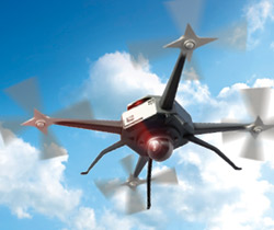
Unmanned Aerial Systems

Photo courtesy AeroVironment, Inc.
Whatever you want to call these remote-control-operated surveillance planes — “drones” being the most colloquial — they will undoubtedly be part of any department’s toolbox by the end of this decade. They can record still and video images, produce heat maps, track suspects or large crowds, and operate with night vision. Best of all, they’re much cheaper than putting a helicopter into the air.
“I think what a UAS does is give law enforcement another tool of technology where I don’t have to put another human being at risk,” says Captain Mark Nelson, Operations Division commander for the Grand Forks Police Department and member of North Dakota FOP Lodge #2. “We use them as part of a comprehensive risk management strategy. If I can use a UAS, even more than using a helicopter pilot, and get that overhead shot without putting my officers in danger, that’s a win-win.”
Like many smaller departments, GFPD doesn’t own a drone. It uses one in cooperation with other agencies, like the Grand Forks Sheriff’s Department (which owns one) and the United States Border Patrol. But the department’s location, in the vast plains near the Canadian border, and in the same city as the University of North Dakota, one of the top aviation higher education institutions in the nation, makes the drone a worthwhile tool of the trade.
The GFPD refers to the drone as an unmanned aerial system — the plane, camera and evidence making up the parts. And, because of increasing questions about privacy and interfering with Federal Aviation Administration (FAA) airspace, Nelson says the department selected five mandated missions in which it will call in a drone:
- Crime and traffic accident scene analysis
- Disaster scene assessment
- Missing-person search
- Suspect search
- Major event vehicular traffic monitoring
So far, the GFPD has deployed a drone for four out of the five types of missions, but Lieutenant Dwight Love, also of the GFPD and a member of FOP Lodge #2, calls open-area searches the “bread and butter” of the UAS. “Think of how much land we can cover with fewer people and volunteers,” says Love. “It’s certainly safer and we don’t have to blindly search for the suspect. If it’s a bad guy and he’s armed with a high-powered rifle, he could make a shot from 300 yards away and we wouldn’t see him.”
Nelson adds that the cost-benefit ratio, along with the level of public safety the department is able to offer its community members and officers, makes the UAS partnership a smart investment.
Fixed-Wing Surveillance Flights
Unlike drones, fixed-wing surveillance flights use mounted cameras on a piloted airplane, like a Cessna, and collect hours of footage from a huge vantage point, as big as 25 square miles. Multiple cameras capture still images that can then be downloaded and put together like the pieces of a puzzle. This allows officers to see events unfold as they happen and offers accurate location mapping because they can see where the story ends, like if a robbery suspect runs into a vacant building and holes up.
In 2013, the Dayton Police Department in Ohio requested that the city purchase 200 hours of flight time from Persistent Surveillance Systems, also based in Dayton, to use for crime-scene mapping and crowd management at large events. The PSS system had already been used in Dayton at a 2008 political rally and at demonstrations for police. City officials, however, denied the request, in part because of privacy concerns.
Lieutenant Eric Henderson of the Dayton Police Department, a member of Ohio FOP Lodge #44, says the department tested fixed-wing surveillance flights twice in 2012 with remarkable results. “We were lucky enough to have the plane in the air when we got a call about a burglary in progress. We were able to see the truck used by the suspects,” he explains. “They were able to direct our officers to where the truck went before our officers went on scene. That’s something that we typically can’t do. We might know the description of the vehicle, but we don’t know where it goes from the scene. With this we did.”
The one limitation of this type of technology is that you can’t get a clear enough image of an actual suspect; it just looks like a dark pixelation that moves through the images. “So we still need boots on the ground,” says Henderson.
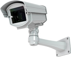
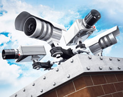
City-Owned Mounted Surveillance Cameras
These little gizmos are nothing new in the private sector, but more municipalities are installing them for crime prevention and tracking. Cincinnati, Cleveland and Toledo are three major cities in Ohio that already have cameras up and running. In fact, a May 2014 Dayton Daily News article reports that “Cincinnati police operate more than 100 cameras in high-activity areas, and the effort has helped solve homicides, bank robberies and other serious crimes. The cameras also contributed to a significant reduction in violent offenses.”
Dayton got on board last year, too, by installing 27 cameras on its city streets. The footage isn’t monitored all the time, unless there is a big event on the police department’s radar they want to keep tabs on. Rather, the footage is often gathered after a crime has been committed so that investigators can track suspects’ movements and hopefully capture some details that will help them identify who is responsible.
“There’s been some research that cameras have reduced property crimes such as theft from motor vehicles and criminal damaging,” shares Henderson. It’s the digital cameras’ ability to store images and information that is proving most useful, though. Researchers at the University of Dayton Research Institute have helped create a new software platform that integrates crime mapping into the footage and data collected from the city’s cameras. The idea is that heavy crime areas will be identified through digital crime analysis, without the use of manpower logging hours of footage. As the system moves toward more real-time outflow where surveillance camera footage is linked to officers’ patrol car computers as it happens, Henderson hopes it will cut down on response time. “We may even get to the point where we can ‘see’ an issue before it’s reported to 9-1-1,” he says.
License Plate Readers
Imagine trying to see a vehicle’s license plate after it goes screaming by you at 90 miles per hour, or trying to find one car that matches a description in a mall parking lot of thousands. Those scenarios play out more often than most civilians realize, and that’s one of the reasons automatic license plate readers are gaining popularity with police departments.
Automatic license plate recognition uses specialized scanners (most often mounted on squad cars) and a digital warehouse of data to identify license plates, search wanted vehicle lists and support criminal investigations. It eliminates the need for officers to manually type in plates and allows them to run hundreds, even thousands, of plates while continuing other patrol duties. In just one year, a sheriff’s department near Austin, Texas, has recovered more than 150 stolen vehicles using license plate readers.
While literally stopping criminals in their tracks is the most heavily marketed aspect of license plate readers, many departments, like Grand Forks, are investigating implementing them into their parking enforcement. AutoVu, one of the leading brands of license plate readers, has incorporated vehicle images, digital wheel chalking, time stamps and GPS coordinates into its software. The idea is that all of this evidence collected in one spot and with one “read” will speed up parking enforcement and decrease disputes.
As license plate readers become one of the fastest and easiest ways to gather data about vehicles while on patrol, manufacturers hope to eventually integrate them with facial recognition software so that the people driving them can be identified, too.
SOCIAL MEDIA AND CROWDSOURCING
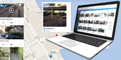
Large Emergency Event Digital Information Repository (LEEDIR)
In 2013, the International Association of Chiefs of Police reported that 86% of 500 law enforcement agencies surveyed used social media for criminal investigations, and more than 80% said it had helped them solve crimes. The virtues of Facebook and Twitter are well established, but another evidence-gathering platform is gaining traction because of its ability to collect and store large quantities of images and video while keeping public informants confidential.
Large Emergency Event Digital Information Repository (LEEDIR) was born following the catastrophic bombings at the 2013 Boston Marathon. Although law enforcement officials wanted members of the public to turn in as many images and videos as they had of the event, the Boston Police Department didn’t have an efficient method to collect, sort and store the data. In fact, their internal servers crashed when people tried to send in evidence. As the investigation unfolded, some members of the Los Angeles County Sheriff’s Department were taking careful note. They began to realize that there wasn’t a sufficient platform to gather eyewitness digital information to help solve crimes on a massive scale. The LASD conceptualized LEEDIR and then collaborated with infrastructure technology company CitizenGlobal and Amazon Web Services to create the platform.
Agencies can register for free at www.leedir.com, which also offers training and certification webinars. If a large-scale crime, like a riot, occurs and an agency needs help collecting images and video evidence from the public, it can activate LEEDIR. CitizenGlobal sends instructions on how to use the system and provide the app to the public. The agency then sends out a press release or holds a news conference requesting the public’s help. After citizens upload material, the agency can access it through a case-sensitive, password-protected portal and organize the images and video into customizable folders. Agencies can have simultaneous investigators in the system and even collaborate within the system. LEEDIR evidence can also be accessed remotely.
So far, LEEDIR has been successfully deployed three times, all in 2014. The Santa Barbara County Sheriff’s Department was the first to use it, when partygoers at an event in the college town of Isla Vista turned violent in April. Police in Keene, New Hampshire, put the call out for the public’s help after a riot broke out in October during the town’s annual Pumpkin Festival. And in that same month, Anaheim officers requested LEEDIR after a large disturbance at Angel Stadium.
Developers believe LEEDIR will be successful for two reasons. First, it keeps the chain of evidence intact, because software allows investigators to see if a picture or video has been altered or edited. Second, relying on traditional sites like Instagram only gives you a selection of cherry-picked images. We all know that people take many more photos of something than they post on social media. Because of LEEDIR’s incredible storage capacity, investigators can ask the public to submit any and all photos from an event.
The best aspect of LEEDIR is that it’s free to use for large-scale events. Departments can sign up to use the program for smaller crimes, but there is a monthly fee attached to that service.
PREDICTIVE POLICING
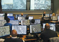
Crime Mapping
Fort Lauderdale, Florida, is filled with tony homes and expensive cars that get left behind every spring as snowbirds head back north. That’s prime season for thieves to break into empty homes and vehicles.
But they may find themselves stymied before they even roll into the neighborhood, thanks to a partnership between the Fort Lauderdale Police Department and IBM. In 2014, the two collaborated on a new predictive policing and crime mapping venture. The concept mines a variety of big data sources, including 9-1-1 call records, crime data, public transportation routes and special events information, and churns that into viable patterns and statistics that police can use to detect crime patterns, environments and anomalies.
Various test runs did well, and the department plans to move forward with the project full time after conversions to a regional communication system are complete in 2015, says Wade Brabble, a lieutenant with the Fort Lauderdale Police Department and member of Florida FOP Lodge #31. “I feel like it’s the wave of the future and a great step that this department has taken in trying the technology. You look at the things that have been done with computer analytics and the programs that are available, from tracking hurricanes to merchandise sales; there’s value in it. Private industries jumped on it full force and it’s about time the public sector got involved in it, as well.”
Brabble experimented with the software while commanding the day shift in the busy northeast section of the city, which includes Fort Lauderdale Beach. The area was always a beacon for burglaries, so Brabble used the software to locate specific areas where the predicted rate for crime climbed above 70%. When he found an area to target, Brabble could better plan his counterattack. “In the absence of any sort of actionable intelligence, there was a huge reliance on the IBM model,” he says. “Sometimes we’d make a decision to relieve our primary officer in that area from calls for service so he could simply work patrol and surveillance. Sometimes it was as simple as putting another officer on a bicycle. It allowed me to better use the resources I had and move people around without any additional cost.”
Some would call it predictive policing, but a better term for it might be probability policing.

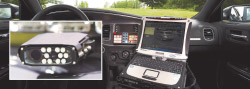
ON THE GO
Mobile Applications
There are plenty of apps that aim to make a police officer’s life easier. From Spanish guides to ballistics calculators, you can have a field day with your phone. But sometimes the best app for an officer to download is one he or she can read during downtime, and that actually has practical and up-to-date legal advice. That’s what you get from the Law Officer’s Pocket Manual app. For less than $10, you receive guidance on defensible police practices based on current case law from the Supreme Court.
This is not an app to whip out during an arrest. Rather, it’s a dynamic tool that encompasses many of the “traps” attorneys love to blame officers for when it comes to vehicle searches, interrogations of formally charged defendants, stop-and-frisk tactics during vehicle stops, and Fourth Amendment search and seizure. The app is compatible with both Android and iOS smartphones.
Editor’s note: Click here to learn about more tech trends on the horizon.